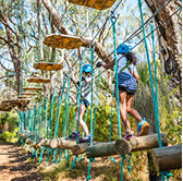
Find out about the City’s wetlands, their ecological importance, how they are managed and protected, key planning requirements, and current projects supporting their long-term health.
About wetlands in the City
A large proportion of the City of Wanneroo is made up of a complex network of wetlands, some of which are interconnected. There are approximately 179 wetlands in the City’s boundary. These wetlands may be managed privately, by State departments or by the City. Further information regarding wetlands can be found in the City’s Draft Local Biodiversity Plan.
Significant wetlands include Lake Joondalup, Lake Pinjar, Lake Jandabup, Lake Mariginiup, Loch McNess, Gnangara Lake, Nowergup Lake, Beenyup Swamp, Walluburnup Swamp, Wilgarup Lake and Lake Adams, which form part of a complex of wetlands extending north-south along the Swan Coastal Plain. These wetlands:
- Contain rare and protected flora.
- Provide habitat for a wide range of native animals.
- Support biodiversity and ecological resilience.
- Offer passive and active recreation opportunities.
- Include paths, access tracks and natural open spaces enjoyed by the community.
Wetlands planning
The City’s Wetlands Local Planning Policy outlines the minimum separation distances and buffer requirements for three wetland management categories when development is proposed on or near a wetland.
Multiple use wetlands
- Usually highly degraded sumplands, drainage basins or damplands.
- Provide little to no ecological function.
- Development is generally acceptable however groundwater levels must be considered due to flooding and acid sulphate soil risks.
Resource enhancement wetlands
- Degraded or partially degraded wetlands with restoration potential.
- Rehabilitation is encouraged and often required during the planning process.
- Ecological function can be improved through revegetation and management.
Conservation wetlands
- Highest management category.
- Protected for their ecological values and wetland functions.
- Development is not supported.
- Require suitable buffers and separation from incompatible uses.
Smart monitoring and management projects
The City is implementing Smart Monitoring and Management projects to enhance operational efficiency, improve service delivery, and support data-driven decision-making across key areas:
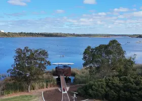
Smart Cities and Suburbs Program – Yellagonga Wetlands Project
The City of Wanneroo and the City of Joondalup received Federal Government funding to trial smart technology for improved wetland protection and decision-making. The project aims to:
- Improve environmental and activity monitoring.
- Enhance data analysis to guide wetland management.
- Increase open-data access for transparency and innovation.
- Improve community engagement and activation of the park.
A buoy fitted with smart sensors has been installed at Lake Joondalup to collect data on pH, temperature, dissolved oxygen, electrical conductivity and other indicators. Additional buoys will be installed across the wetlands to expand data collection and support informed management decisions.
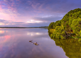
Yellagonga Catchment and Regional Park
Yellagonga Regional Park is jointly managed by the Department of Biodiversity, Conservation and Attractions and the Cities of Joondalup and Wanneroo. It includes Lake Joondalup and Lake Goollelal. The Yellagonga Integrated Catchment Management (YICM) Plan aims to improve the long-term health of the wetlands through:
- Surface and groundwater monitoring
- Assessment of ecological,biologicaland hydrological functions
- Monitoring stormwater inputs
- Revegetation and weed control
- Flora surveys
- Initiatives to protect habitat and enhance amenity.
This collaborative work helps protect one of the region’s most important wetland systems for current and future generations.