South Mindarie Trail - Stop 7

Habitat Connections in the Growing City
Views from Stop 7 on the South Mindarie Foreshore Trail provide good views of the Tamala Conservation Park and other conservation bushland. What can you see?
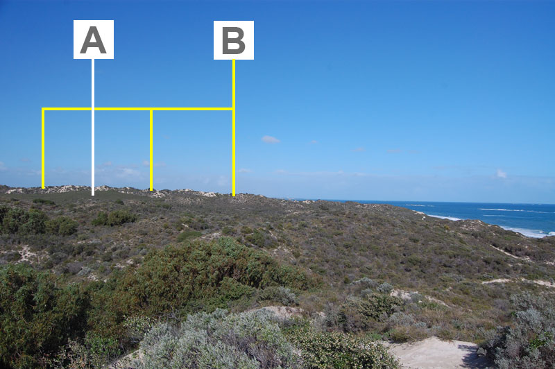
Photo courtesy to the Quinns Rocks Environmental Group Inc.
A - Melaleuca cardiophylla Low Forest to Closed Tall Scrub - the southernmost area of this association.
B - The ridgeline of the largest parabolic dune retained in relatively undisturbed form. Its front is separated by Marmion Avenue and is located within the Tamala rubbish tip.
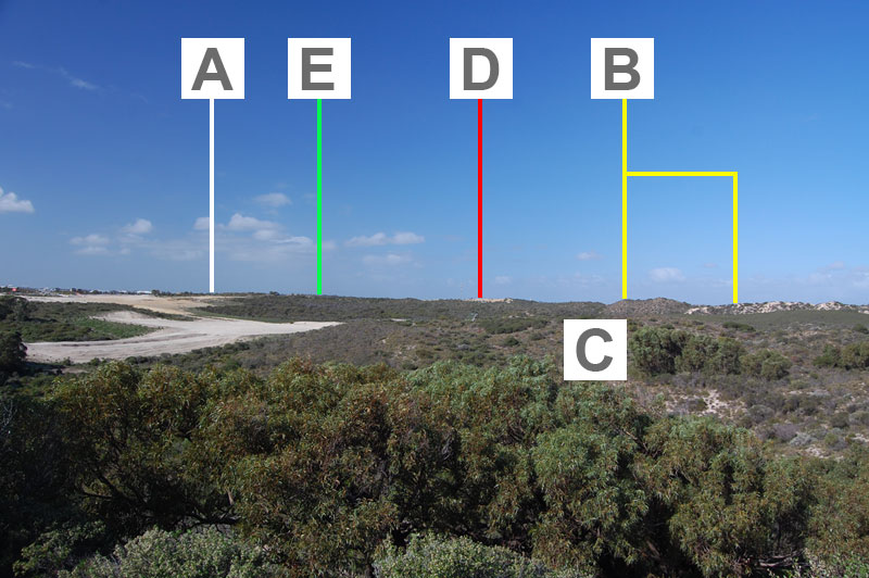
Photo courtesy to the Quinns Rocks Environmental Group Inc.
A - Vegetation retained in public open space within the Catalina subdivision.
B - Continuation of the parabolic dune ridge.
C - Tuart stands
D - Tamala rubbish tip - along the boundaries, vegetation is retained and recognised for its connecting role between the vegetation in Tamala Conservation Park and Neerabup National Park.
E - Neerabup National Park