Yanchep Coastal Management
Project Overview
The City of Wanneroo Coastal Hazard Risk Management and Adaptation Plan (CHRMAP) was completed in 2018 and identified a number of sites vulnerable to coastal erosion along the Yanchep coastline. The CHRMAP recommended that a detailed options assessment is conducted for the management of coastal vulnerability at Yanchep. Additionally, since 2018 excessive winter storm erosion has resulted in the need for regular coastal maintenance works and ongoing beach renourishment at the Yanchep Lagoon to maintain safe beach access, minimise the loss of dunes and improve beach functionality/amenity.
Recent coastal erosion issues and CHRMAP recommendations form the basis behind the Yanchep Coastal Management Project which aims to address the current and future coastal erosion risks and beach access issues along the Yanchep coastline through the implementation of coastal management measures. These coastal management measures will be identified through the completion of a detailed coastal engineering consultancy study (2022/23 to 2025/26) consisting of the following stages:
- Metocean Data Collection;
- Coastal Processes Assessment;
- Coastal Management Options and Beach Access Assessment;
- Community Consultation; and
- Detailed design.
Following the completion and adoption of the Yanchep Coastal Management Study recommendations, the City will progress with the approvals process and subsequent staged construction works. These works will assist with the management of ongoing coastal erosion issues along the Yanchep coastline and will lead to the protection of coastal infrastructure, minimise the loss of dune environment, enable ongoing safe beach access for beach users and surf life saving activities and improve the functionality and amenity of some of the City's most popular beaches.
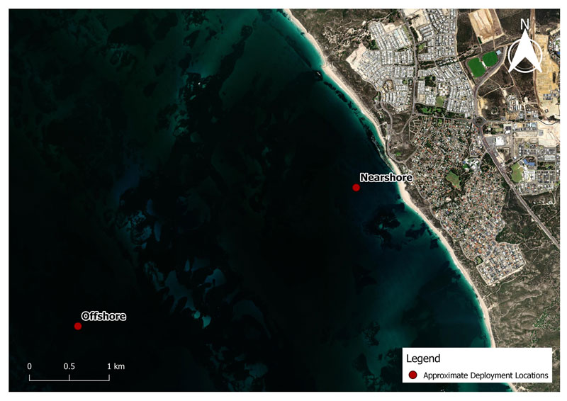
The City of Wanneroo collected metocean (wave, current and water level) data at two locations offshore of Yanchep Lagoon across a 3-month period in winter (July to September 2022) and a 3-month period in summer (December 2022 to February 2023). This local metocean data will be analysed and included in the assessment of coastal processes and numerical modelling of waves and sediment transport along the Yanchep coastline.
A permanent wave buoy was also installed in 2023 offshore of Yanchep Lagoon which provides real time wave information that can be viewed by visiting wawaves.org/wanneroo.
Yanchep Coastal Management Study
The City has engaged coastal engineering consultants Stantec (formally Cardno) to complete the detailed coastal engineering consultancy study. Stantec are currently assessing all available data and completing the coastal processes assessment. This portion of the Yanchep Coastal Management Study is partly funded by the State Government via a Department of Transport Coastal Adaptation and Protection (CAP) Grant.
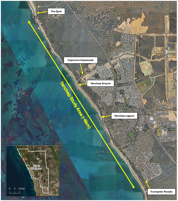
Yanchep Coastal Management Study Area
The City of Wanneroo will be calling for community representatives to join the Yanchep Coastal Management Advisory Group in February 2025. This Group will provide local knowledge and input into the development and implementation of long term costal management measures for the Yanchep coastline. The Nomination Form and Terms of Reference are available by clicking below: